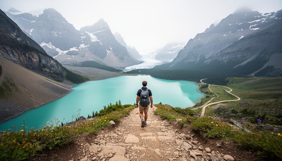
Guide to Hiking the Canadian Rockies: Trails, Practical Information, and Local Tips
The Canadian Rockies hold some of the most spectacular alpine hiking on the planet, with over 1,000 kilometers of maintained trails threading through turquoise glacier-fed lakes, wildflower meadows, and jagged limestone peaks. You’ll find everything from gentle valley walks to multi-day backcountry routes here, spread across four main national parks and several provincial parks along the Alberta-British Columbia border. The real challenge isn’t whether you should hike the Rockies, but rather how to narrow down your options and navigate the permit systems that have become increasingly strict since 2024.
I’ve spent five summers exploring these trails, and I learned the hard way that showing up without a plan is a recipe for disappointment. Popular hikes like Lake Louise’s Plain of Six Glaciers now require timed entry permits that sell out weeks in advance during peak season. But here’s what most guidebooks won’t tell you: the best hiking often happens in the shoulder seasons of late September and early June, when the crowds thin out and you can actually hear the silence of the mountains.
This guide breaks down the top hiking areas across the Canadian Rockies, from the iconic trails around Banff and Jasper to lesser-known gems in Yoho and Kananaskis. You’ll get specific trail recommendations matched to different fitness levels, up-to-date permit information, transportation logistics between trailheads, and the kind of practical tips that come from actual time on the ground.
Why Hike the Canadian Rockies
The Canadian Rockies deliver everything serious hikers dream about: jagged limestone peaks that pierce clear blue skies, turquoise glacial lakes that seem impossibly bright, and vast alpine meadows where you might spot grizzly bears, elk, or mountain goats. This isn’t hype. The scenery here genuinely rivals anywhere on Earth, and unlike many world-class mountain ranges, you can access incredible trails within an hour’s drive of towns with full services, hot showers, and good coffee.
What sets these mountains apart is the variety. You can hike to a historic tea house for lunch, scramble up to a windswept ridge at 2,800 meters, or backpack for days through valleys where you won’t see another person. Families with young kids tackle gentle interpretive trails around turquoise lakes. Experienced trekkers push into remote backcountry where glaciers calve into pristine tarns. The network spans easy, accessible walks and serious alpine routes that demand navigation skills and wilderness experience.
The wildlife factor matters too. You’ll carry bear spray here because you genuinely might encounter black bears or grizzlies. Bighorn sheep often graze beside parking lots. Pikas chirp from rockpiles above treeline. This isn’t a zoo experience, it’s real wilderness where animals live their lives, and you’re the visitor.
Most hiking destinations require serious commitment to reach. The Canadian Rockies sit along the Trans-Canada Highway, with trailheads minutes from Banff, Lake Louise, and Jasper. You land in Calgary, rent a car, and within ninety minutes you’re standing at a trailhead gazing up at mountains that look like they belong on a postcard. That combination of accessibility and genuine wilderness experience is rare anywhere in the world.
Top Hiking Areas in the Canadian Rockies
1. Lake Louise and Moraine Lake Area
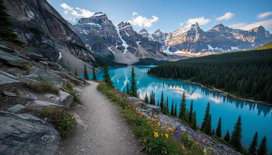
Lake Louise and Moraine Lake sit in a compact area that packs more postcard-worthy trails per square mile than anywhere else in the Rockies. If you only have time for one region, this is it, the turquoise lakes, hanging glaciers, and jagged peaks here define what most people picture when they imagine the Canadian Rockies.
The Plain of Six Glaciers trail starts right from Lake Louise’s shoreline and climbs gradually along the lake’s edge before ascending into an amphitheater surrounded by six glaciers. It’s 14 kilometers round trip with about 370 meters of elevation gain, taking most hikers 4 to 5 hours. The trail ends at a historic tea house where you can refuel before heading back. What makes this hike exceptional is how it transitions from lakeside forest to raw alpine terrain, with Victoria Glacier dominating the view as you approach the tea house.
Lake Agnes Tea House follows a steeper route, gaining 400 meters over just 7 kilometers return. The switchbacks through dense forest open suddenly to reveal a small alpine lake cradled between rock walls, with another century-old tea house serving homemade soup and pastries. Most people complete this in 3 to 4 hours. You can extend it by climbing the additional kilometer to the Big Beehive viewpoint, which offers an aerial perspective of Lake Louise far below.
Larch Valley, accessible from Moraine Lake, is spectacular during late September when the larches turn golden. The 9-kilometer loop gains about 500 meters and takes 3 to 4 hours. It’s more strenuous than the tea house trails but rewards you with expansive meadows framed by the Valley of the Ten Peaks.
Trailheads require early arrival, parking fills by 6 AM in summer. Parks Canada shuttle service from overflow lots helps when you can’t snag a spot.
2. Banff Townsite Trails
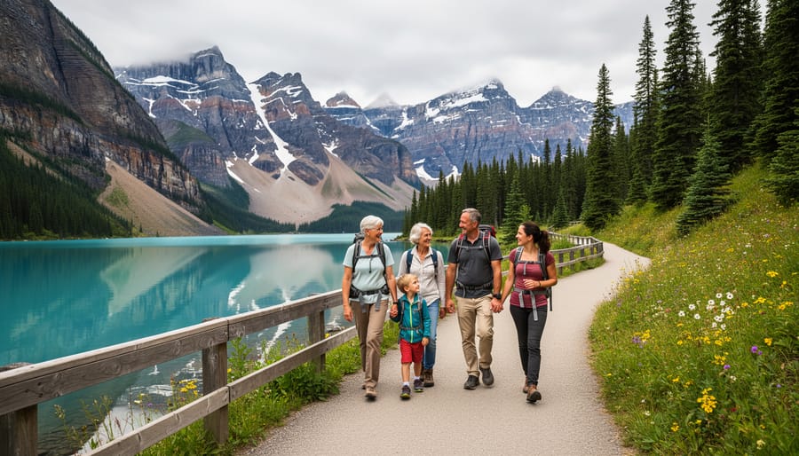
The trails radiating from Banff townsite offer something genuinely valuable: world-class mountain scenery within a short drive or even walk from your accommodation. These hikes work beautifully for families with younger kids, travelers on tight schedules, or anyone needing a gentler acclimatization day before tackling higher elevation routes.
Tunnel Mountain stands out as the perfect introduction to Rockies hiking. The 2.3-kilometer trail gains 250 meters through switchbacks that feel manageable even for casual hikers, yet the summit delivers sweeping views of the Bow Valley and surrounding peaks. I’ve watched five-year-olds conquer this trail, though expect about 60 to 90 minutes round-trip at a leisurely pace.
For a more sustained workout, skip the Sulphur Mountain gondola and earn your views the hard way. The 5.5-kilometer trail climbs 655 meters through forest before emerging at the upper terminal where you can grab lunch alongside gondola passengers. Start early, the trailhead gets packed by mid-morning, and you’ll appreciate cooler temperatures during the climb.
Johnston Canyon pulls massive crowds for good reason. The paved walkway clings to canyon walls, passing Lower Falls at 1.1 kilometers and Upper Falls at 2.7 kilometers. The engineering alone impresses, with catwalks suspended above rushing water. Arrive before 8 a.m. or after 5 p.m. to avoid the worst congestion, especially during July and August. The Ink Pots beyond Upper Falls add another 2.4 kilometers through meadows where crowds thin considerably.
These trails require only a Parks Canada pass, no reservations, making them flexible options when weather closes higher routes.
3. Icefields Parkway Corridor
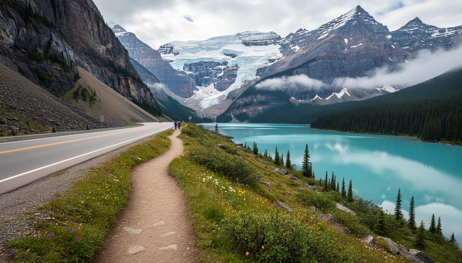
The 230-kilometer stretch of highway connecting Lake Louise to Jasper serves up some of the most accessible alpine hiking in the Rockies. You can literally park your car, walk ten minutes, and find yourself surrounded by glaciers and turquoise lakes that would take days to reach in most mountain ranges.
Parker Ridge stands out as the perfect introduction to high-alpine terrain. The 5.4-kilometer round trip climbs steadily through flowered meadows before cresting a ridge that overlooks the massive Saskatchewan Glacier. It’s short enough for families but delivers that genuine “wow, I’m in the mountains” feeling. The trail sits at high elevation year-round, so even in July you might cross snow patches near the top.
Wilcox Pass offers a quieter alternative with equally dramatic views. This 8-kilometer loop takes you above treeline where bighorn sheep graze the slopes and you can peer down at the Athabasca Glacier from a completely different perspective than the crowded Glacier Skywalk. I’ve spotted grizzlies on the distant hillsides here more than once, bring binoculars.
The short walk to Peyto Lake viewpoint barely qualifies as a hike, but photographers flock here for good reason. That impossible blue color photographs even better than you’d imagine, especially in morning light when the tour buses haven’t arrived yet.
Most Icefields Parkway trailheads fill up by mid-morning in summer. Aim to arrive before 9 AM or after 3 PM for parking and better wildlife photography light.
4. Jasper National Park Trails
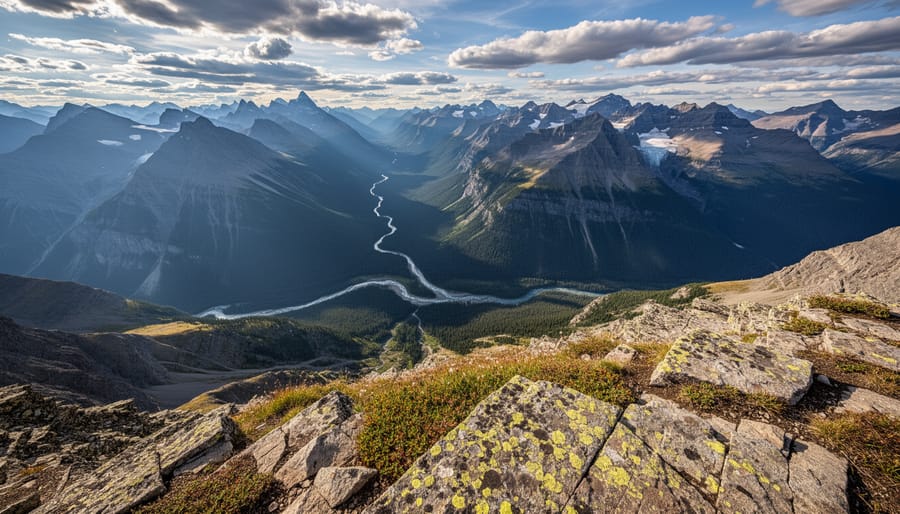
Jasper trades Banff’s Instagram-famous crowds for solitude and wildness. The trails here feel more remote, the wildlife encounters more frequent, and the trailhead parking lots refreshingly emptier, even during peak summer weeks. You’re still in the heart of the Canadian Rockies with jaw-dropping alpine scenery, but the experience skews quieter and more backcountry-focused.
The Skyline Trail ranks among Canada’s premier multi-day hikes, covering 44 kilometers over two to three days through exposed alpine ridgeline. You’ll walk above treeline for extended stretches with panoramic views of glacier-studded peaks, the Athabasca Valley, and endless mountain ranges. Marmots whistle from rockpiles, and caribou occasionally cross the high meadows. Book campsites months ahead through Parks Canada’s reservation system, this trail fills up despite its remote character.
For a shorter alpine fix, Sulphur Skyline delivers massive views for relatively modest effort. The 8-kilometer round trip climbs steeply through subalpine forest before breaking into open ridges overlooking Miette Hot Springs and surrounding peaks. Hit the trail early, then soak trail-weary legs in the hot springs afterward.
Cavell Meadows offers accessible alpine beauty beneath Mount Edith Cavell’s north face. The 8-kilometer loop winds through wildflower-filled meadows with Angel Glacier dominating the skyline. Snow lingers here into July, and the trail often doesn’t fully open until late summer, but the payoff justifies the wait, waterfalls thunder down glacial meltwater channels while marmots sun themselves on boulder fields.
Jasper’s trail network rewards those willing to drive a bit farther and hike without the crowds.
5. Yoho and Kootenay National Parks
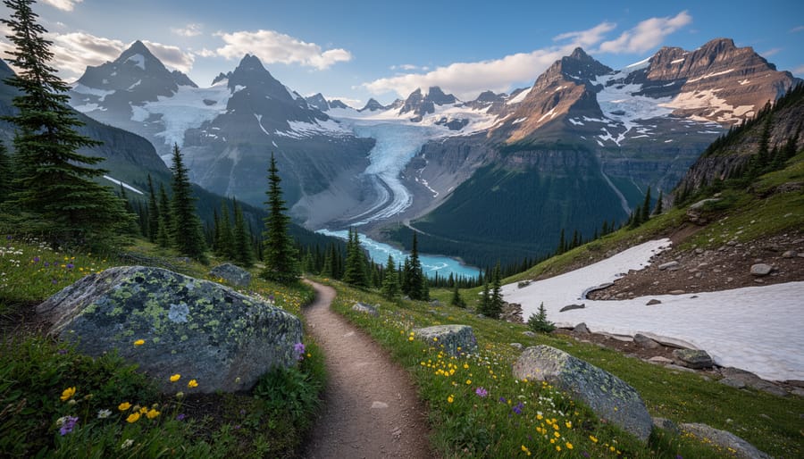
Yoho and Kootenay sit west of the Continental Divide, attracting a fraction of Banff’s visitor traffic while delivering scenery that rivals anything along the Icefields Parkway. These parks reward hikers willing to drive an extra hour with quieter trails and landscapes just as stunning as their famous neighbors.
Lake O’Hara stands out as the crown jewel of Yoho, though accessing it requires advance planning. Parks Canada limits daily visitors through a lottery system for the shuttle bus that covers the 11-kilometer access road. Once there, you’ll find an alpine wonderland of turquoise lakes and towering peaks. The alpine circuit combines Lake Oesa, Opabin Plateau, and Lake McArthur into a full day of hiking through some of the Rockies’ most photographed terrain. The permit hassle pays off with solitude you won’t find at Moraine Lake.
For permit-free alternatives, the Iceline Trail near Takakkaw Falls climbs through wildflower meadows to glacier viewpoints that feel remarkably remote despite being a day hike. The 21-kilometer loop gains significant elevation but the payoff comes in the form of massive ice walls and hanging valleys that few casual tourists ever see.
Over in Kootenay, Stanley Glacier offers an easier introduction to these quieter parks. The 8.4-kilometer round trip passes through a 2003 wildfire zone where new growth frames views of the glacier, creating a landscape that shows both destruction and renewal. Arrive early morning and you might have the moraine entirely to yourself, something almost impossible on popular Banff trails during summer months.
Getting There and Getting Around
Most hikers fly into Calgary International Airport, which sits roughly 90 minutes from Banff and 4.5 hours from Jasper via the Trans-Canada Highway. If you’re arriving from overseas or the coast, connecting through Calgary is typically the fastest route, just be sure to track flight status during peak summer travel when weather delays can ripple through your itinerary. Vancouver works as an alternate gateway, especially if you want the scenic drive through Glacier and Yoho, but add two full days of driving each way. I once did the Vancouver approach and regretted not budgeting enough time, those mountain passes are stunning but eat hours you’d rather spend on trails.
| Gateway City | Nearest Airport | Distance to Banff | Distance to Jasper |
|---|---|---|---|
| Calgary | YYC (Calgary International) | 130 km (1.5 hrs) | 410 km (4.5 hrs) |
| Vancouver | YVR (Vancouver International) | 850 km (9 hrs) | 780 km (8 hrs) |
| Edmonton | YEG (Edmonton International) | 400 km (4.5 hrs) | 360 km (3.5 hrs) |
A rental vehicle is essential for accessing trailheads beyond Banff townsite. Public transit barely exists in the parks, and rideshare services don’t reliably operate outside the main hubs. Book your rental early in summer, availability tightens, and prices spike during July and August.
Parking at popular trailheads like Moraine Lake and Lake Louise fills by 6 a.m. in peak season. Parks Canada now requires timed parking reservations at several high-demand locations, which you book separately from your park pass. Missing your window means you can’t park, period. If you handle flight delays poorly and arrive late, have backup trails ready. The Roam public transit system offers limited bus service to some Banff-area trails, and private shuttles run to Lake Louise, but options thin out quickly beyond the main corridor.
When to Go Hiking
The Canadian Rockies hiking season runs from late June through early September, though you’ll find accessible trails from May into October depending on elevation and snowpack. Most high-alpine trails don’t fully melt out until mid-July, which frustrated me during an early-June trip when I turned back from Parker Ridge just 500 meters from the summit because of waist-deep snow.
July and August deliver the most reliable conditions with warm days, minimal precipitation, and full trail access. These months also bring peak crowds, expect packed parking lots at popular trailheads by 7 a.m. Mid-July through early August showcases alpine wildflowers at their spectacular best, carpeting meadows in paintbrush, lupine, and glacier lilies.
September offers my favorite hiking window. The larch trees turn brilliant gold from mid-September through early October, particularly stunning on trails like Larch Valley and Cavell Meadows. You’ll encounter fewer hikers, though weather becomes less predictable and days shorten noticeably.
Shoulder seasons require flexibility. May and early June work well for lower-elevation trails near Banff townsite, but most alpine routes remain snow-covered. October hiking is possible but risky, I’ve been caught in surprise October snowstorms that turned a pleasant day hike into a white-knuckle descent.
Elevation dramatically affects conditions. A trail starting at 1,400 meters might be clear while one at 2,100 meters remains impassable. Always check recent trip reports before heading out, especially outside peak season.
Permits, Passes, and Reservations
Every hike in Banff, Jasper, Yoho, and Kootenay national parks requires a valid Parks Canada Discovery Pass. You can purchase a daily pass for around $10 per adult or an annual pass for roughly $70, which covers all national parks across Canada. Buy passes online before your trip, at park gates, or at visitor centers. If you’re planning multiple days of hiking, the annual pass pays for itself quickly.
Beyond the basic entry pass, certain high-demand trails require advance reservations. Lake O’Hara is the most competitive, using a lottery-based reservation system that opens months ahead. Spots fill within minutes of release. The shuttle bus and camping permits are tied to this lottery, so you cannot just show up and hike in without a reservation.
Backcountry camping permits are required for overnight trips and must be reserved through the Parks Canada website. Some trails like Skyline in Jasper have quotas that fill up during July and August. Day-use parking reservations launched at several overcrowded trailheads including Moraine Lake and Plain of Six Glaciers. Check specific trail pages before you go, as the system expands each year to manage crowds.
What to Pack and Wear
Mountain weather in the Rockies shifts quickly, I’ve started hikes in bright sunshine and descended through sleet in the same afternoon. Your pack should balance preparedness with reasonable weight, especially since you’ll gain significant elevation on most trails.
Start with the ten essentials adapted for Rocky Mountain conditions:
- Navigation tools (downloaded offline maps, since cell service is unreliable)
- Sun protection (sunscreen, sunglasses, hat, UV intensity increases with altitude)
- Insulation layer (fleece or down jacket even in summer)
- Illumination (headlamp with fresh batteries for unexpected delays)
- First-aid supplies including blister treatment and pain relievers
- Fire starter and matches in waterproof container
- Repair kit and multi-tool
- Nutrition (high-energy snacks plus extra for delays)
- Hydration (2-3 liters depending on trail length and heat)
- Emergency shelter (lightweight emergency blanket)
Bear spray is mandatory, not optional. Carry it in an accessible holster on your hip or pack strap, and know how to use it before you need it. This matters whether you’re hiking with a group or prioritizing solo travel safety on the trails.
For clothing, think layers. A moisture-wicking base layer, insulating mid-layer, and waterproof shell jacket handle most conditions. Skip cotton entirely, it stays wet and loses warmth. Proper hiking boots with ankle support and good tread make a substantial difference on rocky, steep terrain. Break them in before your trip to avoid painful blisters at elevation.
Bring more water than you think you need. High altitude and exertion increase consumption, and while mountain streams look pristine, treating water adds time you might not have on a tight schedule.
Local Tips from the Trail
Start popular trails like Lake Louise or Moraine Lake by 6 AM during summer months. The parking lots fill by 7:30, and you’ll have the first hour of hiking in peaceful solitude before the tour groups arrive. I learned this the hard way after driving up at 9 AM on a July morning, circling full lots for an hour, and eventually turning back.
Always carry bear spray on your hip, not buried in your pack. I keep mine in an outside pocket where I can grab it in two seconds. Make noise on blind corners and in dense forest by talking normally or clapping every few minutes. If you spot a bear, stop moving, speak calmly, and back away slowly without turning your back. Never run. Black bears usually bluff charge and veer off, but grizzlies require you to play dead if contact occurs, curling into a ball with hands protecting your neck.
Do I really need bear spray?
Yes, absolutely. Both black bears and grizzlies inhabit these mountains year-round, and encounters happen regularly on backcountry trails.
Are trails well-marked?
Most popular trails have clear signage and worn paths, but remote routes may have minimal markers. Always carry a map and don’t rely solely on phone GPS, as service is spotty.
Can I hike alone safely?
Solo hiking is common but increases wildlife risk. Make extra noise, tell someone your itinerary, and stick to busier trails if you’re uncomfortable.
How do I know if weather is turning dangerous?
Watch for darkening clouds building over peaks, sudden temperature drops, or wind picking up. If you hear thunder, descend immediately as alpine ridges expose you to lightning.
On narrow mountain paths, the uphill hiker has right of way since they have momentum and limited sightlines. Step aside on the downhill edge when you hear others approaching from below.
Watch the peaks for weather cues. Clouds forming caps over summits or moving fast across ridges signal incoming systems. Turn back if storms approach, even if you’re close to your destination. Refill water from fast-moving streams above treeline rather than stagnant alpine lakes. For sunrise, Sulphur Mountain and Parker Ridge face east with unobstructed views. Moraine Lake’s valley captures golden-hour light beautifully in evening.
The Canadian Rockies deliver hiking experiences that few places on Earth can match. Whether you’re taking a gentle stroll around Moraine Lake, pushing yourself on the multi-day Skyline Trail, or discovering hidden alpine meadows in Yoho, these mountains offer something meaningful for every type of hiker.
What makes this region truly special isn’t just the jaw-dropping scenery, though those turquoise lakes and sawtooth peaks certainly help. It’s the combination of accessibility and wilderness, the chance to see a grizzly from a safe distance, and the way a challenging climb opens up to views that make every step worthwhile.
With the practical details covered, permits secured, gear packed, and trails chosen, you’re ready to experience these mountains firsthand. The trailheads are waiting, the alpine air is crisp, and those summit views aren’t going to photograph themselves.
Start planning your dates, book those accommodations early, and get ready for the kind of hiking that reminds you why you started exploring mountains in the first place. The Canadian Rockies have a way of exceeding expectations, even high ones.